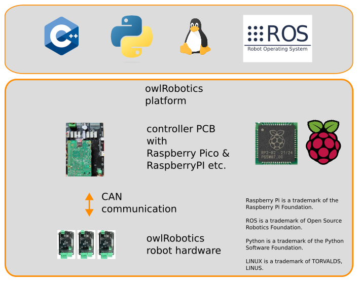
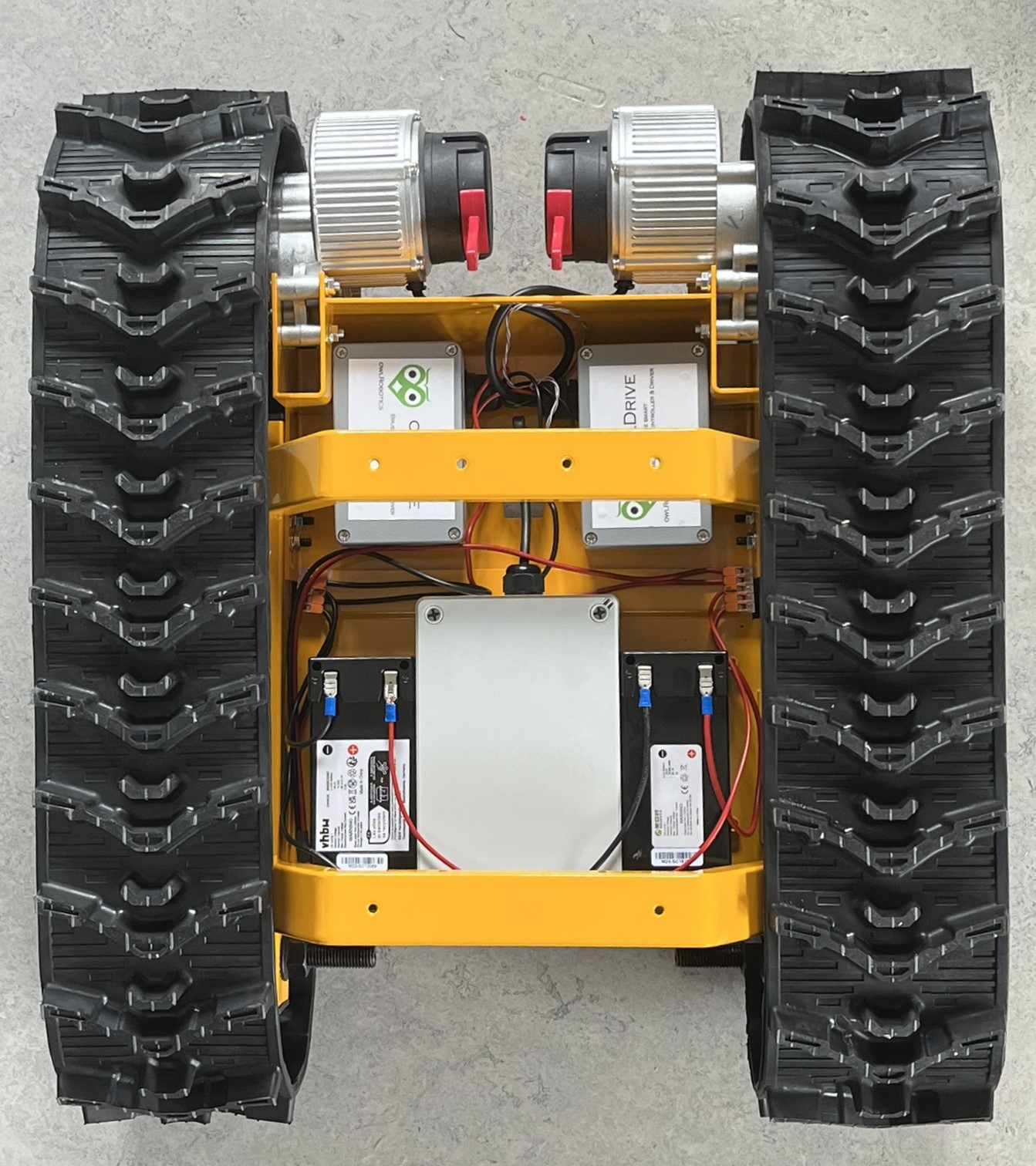
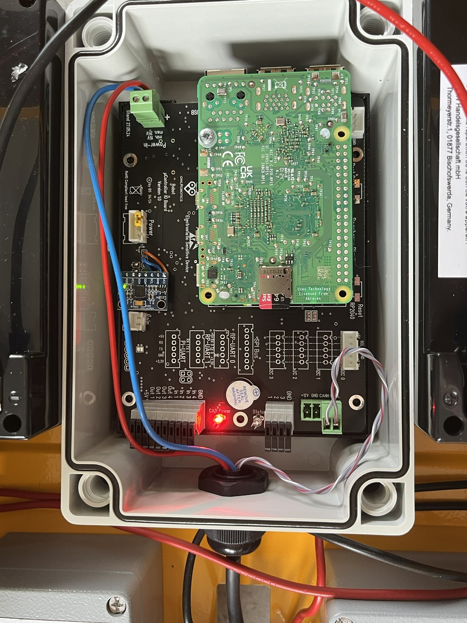
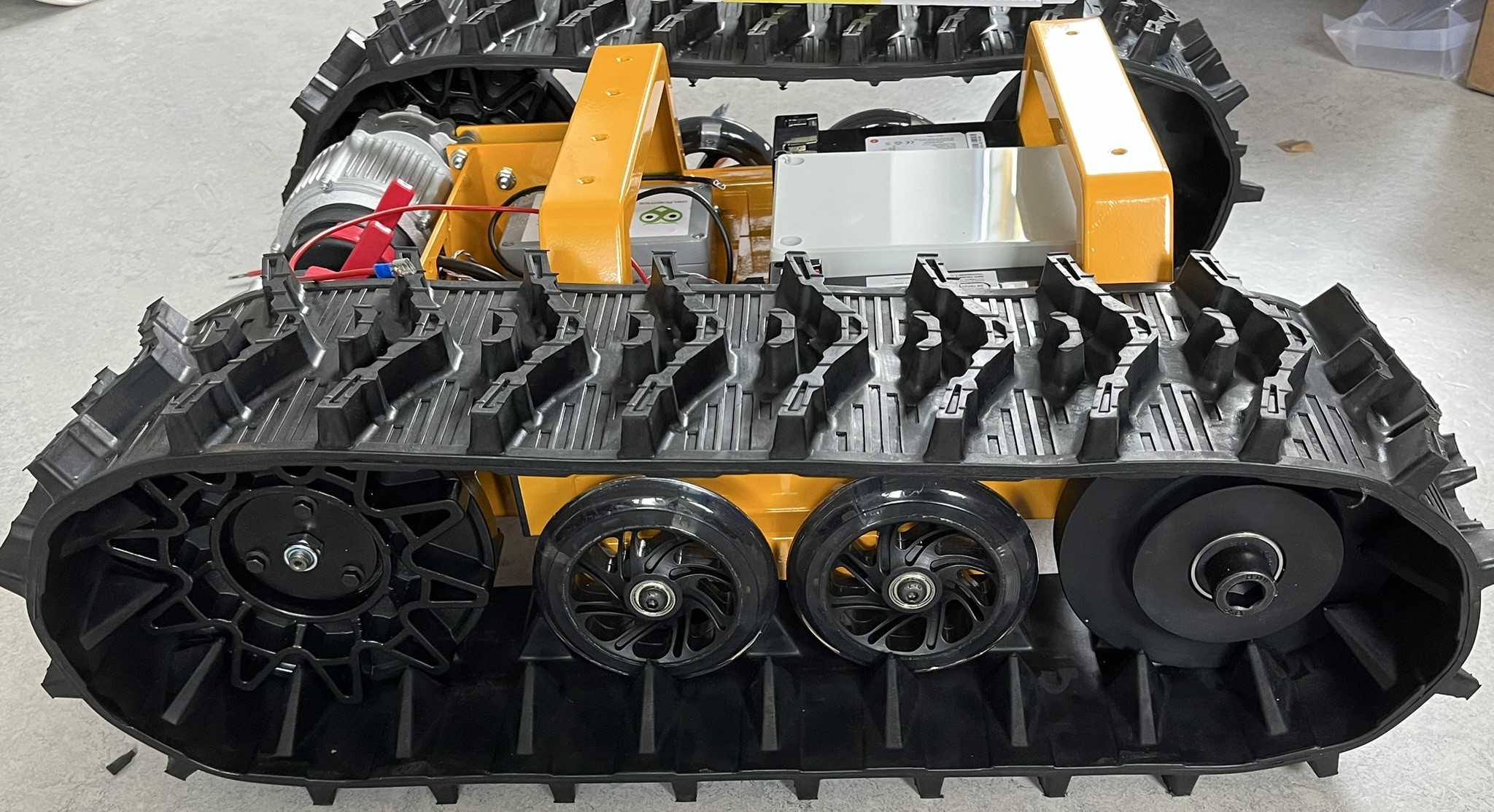
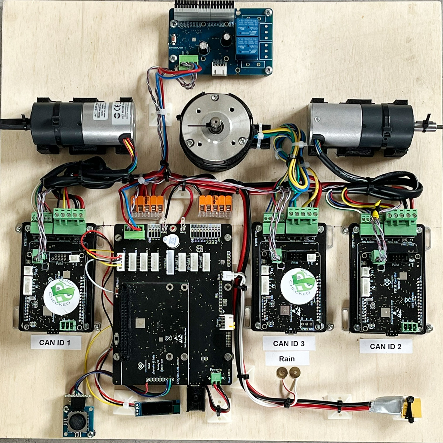
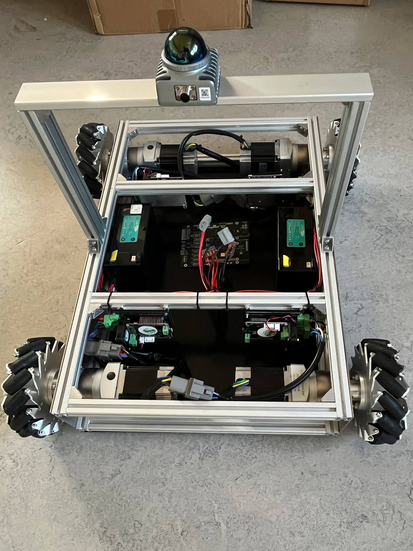
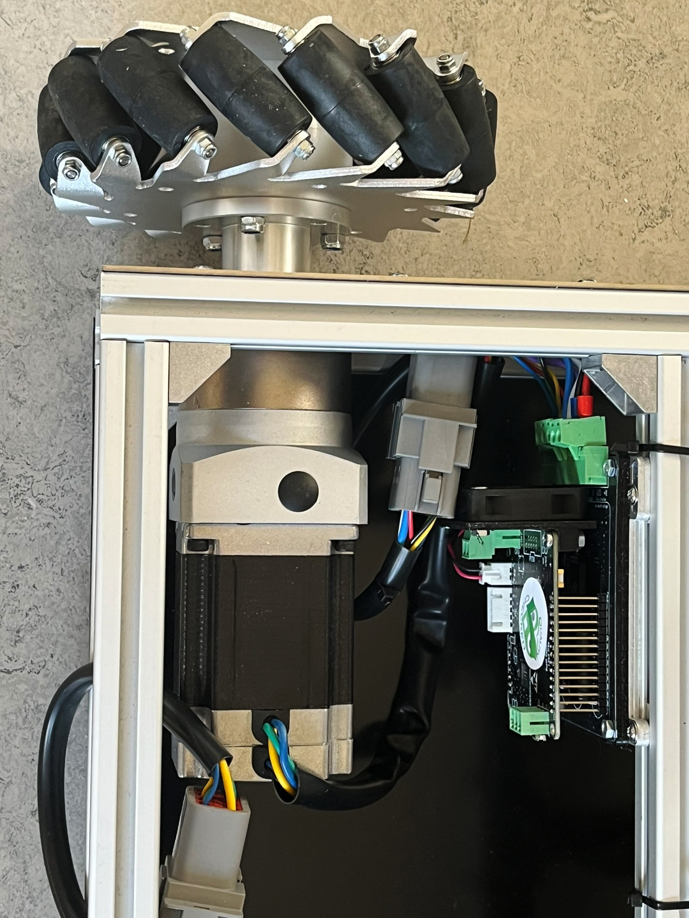
3D LiDAR product finder

Download the document as PDF here.
or here;3D LiDAR product finder - Page

You will find LIDARS in our store, klick here


Depending on your specific application usage, we can assign your application to one or more of the following LiDAR scenarios:

  • 3D Odometry
  • Localization
  • Mapping/3D scanning/ 3D measurement
  • Object recognition
  • Object tracking
  • Obstacle detection
  •  
  •  
  •  
  •  

read more here;3D LiDAR product finder - Page

'cone' localization (up to 30m) with arbitrary number of traffic cones at arbitrary places using a Livox Mid-360 LiDAR (360x59° FOV) In this owlRobotics project, We are using arbitrary traffic cones (as perimeter) to define a working area for a robot within 30m using a Livox Mid-360 LiDAR (360x59 FOV) on the robot. Uses LiDAR localization ( https://github.com/SylarAnh/fast_lio_... ) and cone detection. In this cone detection approach, we don't use any cone geometry. At 30m distance, the LiDAR would not be fast enough on a moving robot (5 Hz) to capture any geometry in a single frame. Here, we just use the cone reflectivity (1 point for each cone) to filter cones and constraints (surrounding points) to further filter the cones. The cool thing here is that the Livox non-repetitive scanning pattern always returns at least 1 point for each cone and this up to 30m.


A new challenge for our owlDrive.
Actually, we focused on moving robots with the owlDrive. But a customer became aware of our software synchronized motors and asked us to control more than 130 motors synchronized to animate an object and move it synchronized. We didn't have such a high number of networked controllers in mind during development and neither did the animation, but after checking the requirement, we were able to determine that the owlDrive masters these requirements, with very little adaptation to the software. Among other things, we still must integrate a 4th operating mode, which reaches the specified end position in a given time. Actually, you specify the speed at which the point is to be reached. If, however, in a synchronized lifting function, the first motor must lift the object by one meter, but the last motor has to lift it 2 meters, the first motor would reach the end point in half the time. But we want both motors to reach their end point at the same time. But that's not an issue for our powerful controller, even if it requires more than 130 motor units to synchronize within a few milliseconds. Thus, the owlDrive can now also be used as a modification as owlMashDrive for mechanical animations and synchronized sequence controls. Do you also have complex applications in which motors have to behave synchronously? We would be happy to check whether the owlDrive can also easily implement your requirements. (Video, theoretical simulation of networked owlDrive-controlled motor network)

Person tracking with the LSLIDAR C16 LIDAR in the range above 20 meters

Task:

For a autonomic cleaning robot, the user must define easily and quickly a working, which the robot travels in lanes.

Approach;

Our preferred system for such a task, an exact 1-2cm accurate GPS-RTK navigation cannot be used here, as the cleaning system is also used in halls and covered areas. That's why we decided to use an LSLIDAR C16 LIDAR with a range of 120m, based on our SLAM, to realize indoor and outdoor navigation by tracking the way the user goes to define the area.

Problem:

With its 16 laser channels, the LSLIDAR C16 has a long range and is ideally suited to carry out an exact location determination and mapping of the environment via the SALAM software and also to monitor the robot's close working area for small and large obstacles. Due to its aperture angle, the first 8 laser beams emit at a +14° angle, the 8 lower laser beams at a -16° angle, which means that a fan of up to 16 beams hits the object, e.g. a person, at close range. As the distance of the person increases, less and less of the laser beams hit the person. Due to the opening angle, they hit the ground beforehand, which we need for navigation or they go over the person, which leads to the loss of point reflection. Even larger objects, such as people, are lost in the point cloud at a distance and the object is lost.

Solution:

Of course, an LSLIDAR with 32, 64 or 128 beams solves the problem perfectly, but leads to significantly higher costs for the overall project, especially since the LSLIDAR C16 basically covers the areas. The solution is our algorithm, which filters out the few reflection points from the moving object, cumulates them and thus determines the position of the object and can thus track its path.

This can be clearly seen in the video, how the algorithm finds and tracks the object despite decreasing reflections.

C16PersTrack.png


Heatmap

With our GPS tracking system, we can't just locate a robot. We can also use the robot to create maps with sensor values. Here you can see the Wi-Fi signal strength of an outdoor surface. The cm-accurate detection of ground sensors or sensors of other kinds can also be implemented. An interesting application would be, for example, soil analysis on lawns, agricultural areas, or plantations in order to carry out the use of fertilizers in the 2nd step with square meter precision.

About owlRobotics GmbH

owlRobotics GmbH stands for high precision navigation algorithms for self driving robots like lawn mowers and similar vehicles, based on our Sunray-OS or open standards.

We use cookies

We use cookies on our website. Some of them are essential for the operation of the site, while others help us to improve this site and the user experience (tracking cookies). You can decide for yourself whether you want to allow cookies or not. Please note that if you reject them, you may not be able to use all the functionalities of the site.